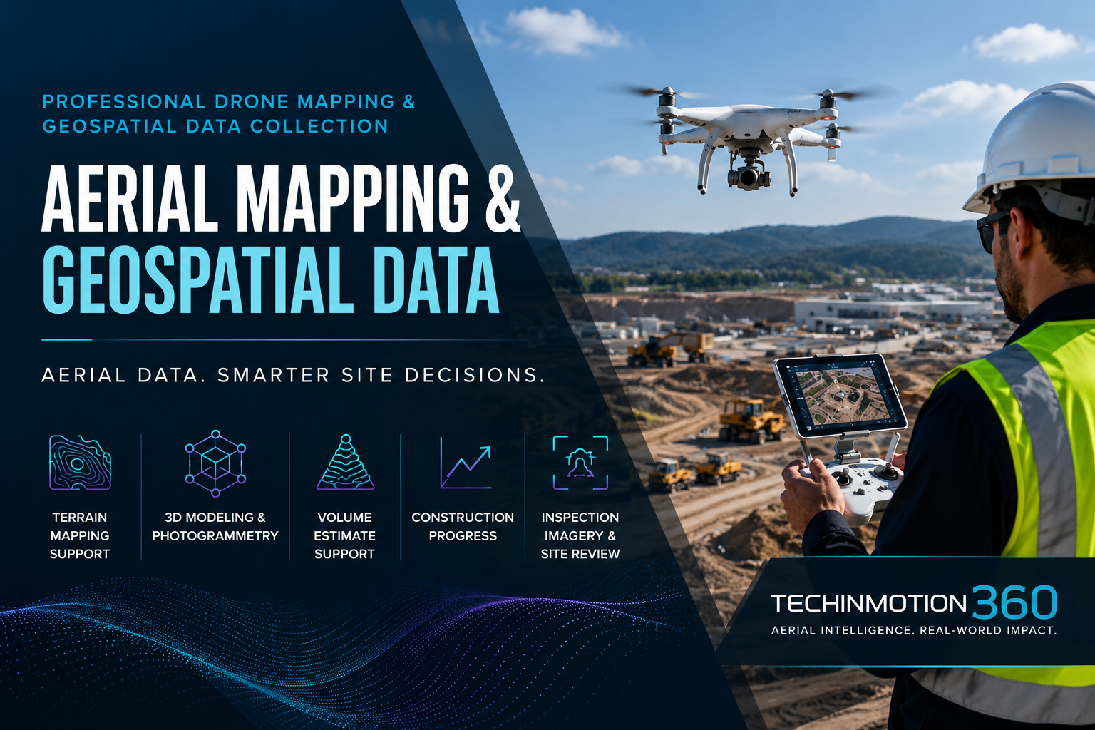
PROFESSIONAL DRONE MAPPING & GEOSPATIAL DATA COLLECTION
Aerial Mapping, Photogrammetry & Geospatial Data Collection for Smarter Site Decisions
TechInMotion360 provides professional aerial mapping and drone-based geospatial data collection services for construction, land development, infrastructure, mining, agriculture, environmental monitoring, and commercial project planning.
We help project teams capture aerial site data, create visual mapping deliverables, monitor progress, inspect infrastructure, support volume estimate workflows, and turn drone-based imagery into practical site intelligence. From orthomosaic maps and digital elevation models to point clouds, 3D mesh models, construction progress documentation, and LiDAR-supported data capture, TechInMotion360 helps businesses better understand their sites with greater speed, clarity, and safety.
Built for construction, land development, infrastructure, aggregates, agriculture, environmental projects, and commercial site planning.
The TechInMotion360 Advantage
Drone Mapping Services Built for Real Project Work
Every site has different requirements. Some projects need clean aerial documentation. Others need orthomosaic maps, elevation models, contour visuals, 3D models, stockpile volume estimate support, progress comparisons, or inspection imagery.
TechInMotion360 structures each mapping project around the data your team needs, the site conditions, the requested deliverables, and the intended use of the final files. Our goal is to help your team collect better site information, reduce unnecessary manual exposure, and make better decisions with clear aerial data.
🎯Tell us what you need mapped, inspected, documented, estimated, or modeled, and we will help identify the right scope for your project.
This is a business-to-business service. Pricing is not based on a generic product page because every project depends on:
- ✓Location & Acreage
- ✓Flight Complexity
- ✓Airspace Considerations
- ✓Required Deliverables
- ✓Data Processing & Scheduling
- ✓Project Data Requirements
Aerial Mapping & Geospatial Data Services
TechInMotion360 provides drone-based mapping and aerial data services for teams that need clear, repeatable, and useful project information.
Aerial Photogrammetry & Mapping
Uses overlapping drone imagery to create 2D and 3D visual mapping deliverables for site documentation, planning support, and visual review.
- Best For:
- Construction sites
- Land development
- Commercial property documentation
- Infrastructure projects
- Site planning
- Agricultural analysis
- Environmental monitoring
Terrain Mapping Support
Drone mapping can support terrain review by capturing aerial data for elevation models, contour visuals, slope information, and site condition review.
- Best For:
- Land development
- Site planning
- Site planning
- Drainage review support
- Grading review support
- Terrain visualization
- Commercial project planning
- Construction documentation
Volume Estimate Support
Supports volume estimate workflows for stockpiles, aggregate piles, excavation areas, material tracking, and construction site planning.
- Best For:
- Site planning
- Aggregates
- Construction
- Excavation documentation
- Material inventory support
- Earthmoving documentation
- Stockpile tracking
Construction Progress Monitoring
Provides regular aerial updates, mapping deliverables, 3D visualization, site comparison views, and project progress documentation.
- Best For:
- General contractors
- Developers
- Owners
- Project managers
- Construction firms
- Infrastructure contractors
- Commercial real estate teams
3D Modeling & Mapping
Creates 3D visual representations of terrain, buildings, infrastructure, roads, and project sites for documentation, planning support, and site communication.
- Best For:
- Infrastructure documentation
- Construction documentation
- Site development
- Facility review
- Roads
- Bridges
- Commercial buildings
Land Development Mapping Support
Supports land planning, site development, existing condition documentation, access planning, terrain visualization, and construction planning through aerial mapping.
- Best For:
- Developers
- Property owners
- Planning teams
- Construction teams
- Commercial land projects
- Site development teams
- Project managers
Infrastructure Inspection Imagery
Documents visible conditions for utility corridors, roads, bridges, drainage areas, pipelines, power lines, and commercial infrastructure assets using aerial imagery and mapping data.
- Best For:
- Utilities
- Municipalities
- Industrial operators
- Pipeline teams
- Transportation projects
- Infrastructure owners
- Maintenance teams
Environmental Monitoring
Documents shoreline erosion, land disturbance, vegetation change, crop conditions, wildlife habitat areas, and environmental site conditions using aerial imagery and repeatable mapping workflows.
- Best For:
- Environmental consultants
- Agriculture
- Conservation projects
- Shoreline monitoring
- Land management
- Vegetation review
- Environmental documentation
Disaster Documentation
Captures aerial data for damage documentation, site condition review, response planning support, and recovery coordination after floods, wildfires, storms, or other site-impacting events.
- Best For:
- Emergency planning
- Damage documentation
- Municipalities
- Property owners
- Recovery teams
- Infrastructure operators
- Site condition review
Mapping Deliverables Your Team Can Actually Use
TechInMotion360 provides drone-based mapping and aerial data services for teams that need clear, repeatable, and useful project information.
Orthomosaic Maps
High-resolution top-down site images processed into map-style deliverables for visual review, documentation, planning support, and project communication.
Use Cases: Site planning, Progress documentation, Site condition review, Land development documentation, Construction monitoring, Commercial property documentation
Digital Elevation Models
Represent terrain and surface height for site visualization, planning support, terrain review, and project documentation.
Use Cases: Terrain review, Drainage review support, Grading review support, Site visualization, Planning support, Project documentation
Point Clouds
Dense 3D data point collections representing visible surfaces, terrain, structures, or infrastructure captured during aerial data collection.
Use Cases: 3D visualization, Infrastructure review, Terrain modeling, Site documentation, Mapping workflows, Project review
3D Mesh Models
Textured 3D surfaces for realistic visualization of sites, structures, buildings, terrain, and infrastructure.
Use Cases: Project visualization, Site review, Stakeholder presentations, Building documentation, Infrastructure visualization, Existing condition documentation
Contour & Elevation Data
Contour lines and elevation layers help visualize slope, grade, terrain changes, and drainage-related site conditions.
Use Cases: Land planning, Terrain review, Slope visualization, Drainage review support, Grading review support, Site documentation
Volume Estimate Reports
Supports estimated stockpile volumes, material tracking, aggregate inventory review, and earthwork documentation.
Use Cases: Stockpile volume estimates, Aggregate inventory support, Earthwork documentation, Material tracking, Construction planning, Site condition review
Progress Documentation Packages
Recurring drone captures can be organized into documentation packages with aerial images, progress comparisons, map views, and site condition reports.
Use Cases: Owner updates, Contractor documentation, Project manager review, Stakeholder reporting, Construction progress records, Site condition documentation
Industries We Serve
Drone mapping supports industries where clear site visibility, documentation, progress tracking, and repeatable aerial data collection are important.
Construction
Supports site documentation, progress monitoring, earthwork documentation, planning support, owner updates, and visual project records.
Mining & Aggregates
Supports stockpile volume estimates, material movement documentation, pit monitoring, inventory review, and reduced unnecessary manual exposure.
Urban Planning
Supports site visualization, infrastructure documentation, land use review support, development planning support, and road corridor documentation.
Agriculture
Supports crop condition review, irrigation pattern documentation, field condition monitoring, vegetation review, and land change documentation.
Archaeology
Supports site documentation, terrain visualization, non-invasive visual review, aerial imagery records, and project documentation
Infrastructure & Utilities
Supports visual documentation of utility corridors, power lines, pipelines, roads, bridges, drainage areas, and infrastructure assets.
Environmental & Land Management
Supports erosion documentation, shoreline change monitoring, vegetation review, habitat area documentation, and land disturbance monitoring.
Commercial Land Development
Supports early-stage planning, existing condition documentation, terrain visualization, access planning, and site documentation.
Why Use Drone Mapping for Your Project?
Traditional ground-based documentation can be time-consuming, limited in visibility, and difficult to repeat across large or active sites. Drone mapping gives project teams a safer and more efficient way to capture aerial site data from above.
Faster Site Visibility
Capture large areas faster and give teams a clearer view of the full site.
Safer Data Collection
Reduce unnecessary exposure to unstable terrain, heavy equipment, stockpiles, utility corridors, and hard-to-access locations.
Better Project Communication
Give owners, contractors, project managers, and stakeholders clear visual information they can review and compare.
Useful Mapping Deliverables
Turn aerial imagery into maps, models, elevation visuals, point clouds, 3D surfaces, and volume estimate deliverables.
Repeatable Progress Tracking
Capture consistent aerial data over time to review site changes and maintain project records.
Better Planning Support
Use aerial data to support planning, site development, inspection imagery, environmental monitoring, and project management.
How the Mapping Process Works
Every project begins with understanding what the data needs to support. TechInMotion360 reviews the project type, location, requested deliverables, flight needs, site conditions, and timeline before determining the best approach.
Project Information Review
Learn about your site, project goals, location, industry, timeline, and required deliverables.
Scope & Deliverable Planning
We identify requested outputs such as orthomosaic maps, elevation models, point clouds, 3D models, volume estimate reports, inspection imagery, and progress documentation.
Flight Planning & Coordination
Review site access, airspace considerations, safety requirements, scheduling, and project-specific restrictions.
Aerial Data Capture
Drone flights capture requested imagery or mapping data, including top-down imagery, angled imagery, inspection imagery, terrain coverage, or progress documentation.
Processing & Quality Review
Captured data is processed into requested deliverables such as maps, elevation visuals, contour visuals, 3D models, inspection imagery, and volume estimate reports.
Delivery & Project Review
Final deliverables are provided in the agreed format. For complex projects, TechInMotion360 can review the outputs with your team and discuss next steps if additional documentation is needed.
Request Mapping Information
Every mapping project is different. TechInMotion360 does not use a generic price page because each job depends on location, site size, deliverables, flight complexity, data processing, scheduling, access, and accuracy requirements. Submit your project details and we will review the scope before providing next steps.
Disclaimer: Submitting this form does not create a service agreement or guarantee project availability. TechInMotion360 will review your request and respond with next steps based on project scope, location, requested deliverables, scheduling, access, site conditions, and technical requirements.
Important Use & Data Limitation Notice
Drone mapping can provide useful visual, documentation, modeling, and measurement-support deliverables, but results depend on project scope, equipment, flight conditions, ground conditions, data processing, vegetation, visibility, site access, and intended use.
TechInMotion360 provides aerial mapping, geospatial data collection, visual site documentation, inspection imagery, 3D visualization, construction progress documentation, LiDAR-supported data capture, and volume estimate support. TechInMotion360 does not provide legal boundary determinations, property line certifications, plats, stamped legal documents, or regulatory approval guarantees.
Project deliverables should be reviewed for suitability before being used for construction, permitting, design, regulatory, insurance, or other high-reliance decisions.
Drone Mapping FAQ
Aerial photogrammetry uses overlapping drone images to create visual mapping deliverables such as orthomosaic maps, elevation visuals, 3D terrain models, and other project documentation outputs.
Drone mapping can support survey workflows and provide valuable aerial data, but does not automatically replace a licensed land survey. Legal boundary work, ALTA/NSPS surveys, certified documents, and official submissions may require a licensed surveyor.
Depending on project scope, TechInMotion360 can provide orthomosaic maps, digital elevation models, point clouds, 3D mesh models, contour visuals, volume estimate reports, progress documentation, inspection imagery, and other mapping outputs.
Yes. Recurring aerial mapping and documentation for construction sites — progress comparison, site conditions, stakeholder updates.
Yes. Drone mapping can support stockpile volume estimate workflows for aggregates, construction, excavation documentation, and material inventory support. Results depend on site conditions, data quality, capture method, visibility, and processing workflow.
LiDAR-supported data capture may be available for projects involving vegetation, complex site conditions, corridor documentation, or advanced site visualization needs. Availability depends on project scope, equipment, site conditions, and requested deliverables.
Pricing depends on location, site size, requested deliverables, flight complexity, data processing, travel, scheduling, access, site conditions, and project data requirements. TechInMotion360 reviews each project individually.
Please provide the project location, industry, site size, requested deliverables, project timeline, access requirements, and what you need mapped, inspected, documented, estimated, or modeled.
Yes — roads, bridges, utility corridors, power lines, pipelines, drainage areas, and other infrastructure assets.
Yes. Recurring drone mapping for progress tracking, change comparison, completed work documentation, and visual project records.
Need Better Aerial Data for Your Next Project?
TechInMotion360 helps project teams capture, visualize, model, and document sites with professional drone mapping workflows. Whether you need a one-time aerial map, recurring construction progress updates, stockpile volume estimate support, inspection imagery, environmental monitoring, infrastructure documentation, or requested mapping deliverables, we can help define the right scope for your project.
Not sure what deliverables you need? Send us the project details and we will help guide the next step.
Disclaimer: Drone mapping deliverables vary based on project requirements, site conditions, flight feasibility, visibility, processing workflow, data quality, and intended use. TechInMotion360 provides aerial mapping, geospatial data collection, site documentation, inspection imagery, 3D visualization, LiDAR-supported data capture, and volume estimate support. TechInMotion360 does not provide legal boundary determinations, property line certifications, plats, stamped legal documents, or regulatory approval guarantees.
© 2026 TechInMotion360. All rights reserved.